Terrain Category 1
Overview
Terrain Category 1 (TC 1) describes very exposed open terrain with few or no obstructions and enclosed, limited-sized water surfaces. This category applies at serviceability and ultimate wind speeds in all wind regions.
Why This Is Important
- Correctly identifying terrain categories ensures accurate wind load calculations.
- Prevents underestimating wind pressure on structures in highly exposed areas.
- Improves structural design and safety in open or coastal environments.
Examples of Terrain Category 1
- Flat, treeless, poorly grassed plains
- Rivers, canals, and lakes
- Large car parks
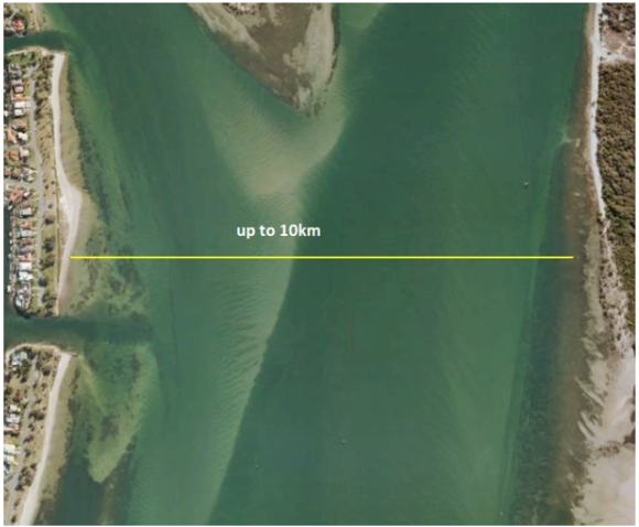
- Enclosed bays extending less than 10 km in the wind direction
Tips, Best Practices & Troubleshooting
- When assessing a site, look for any obstructions (e.g., buildings, trees, hills). If none exist, TC 1 is likely applicable.
- Use aerial mapping tools (e.g., Google Earth) to visually confirm terrain exposure.
- If unsure, consult engineering support to verify the correct category.
Related Resources
Request Engineering (Site Check)
Review & Updates
Version History:
- v1.0 – 18 March 2019
- v2.0 – 31 July 2025
Article Information
- Category: Engineering & Site Specifications
- Target Audience: Estimators, Sales Coordinators, Franchise Users
- Business Owner:
- Version: v2.0
- Last Reviewed: 31 July 2025