Terrain Category 2.5
Overview
Terrain Category 2.5 (TC 2.5) describes terrain with a few or isolated obstructions, representing an intermediate classification between TC 2 and TC 3. It is typically used for developing outer urban areas or large acreage sites with scattered buildings or vegetation.
Why This Is Important
- Provides a more accurate classification for areas that don’t clearly fit into TC 2 or TC 3.
- Ensures appropriate wind loading calculations in semi-developed zones.
- Helps guide estimators and engineers in selecting the correct terrain factor.
Examples
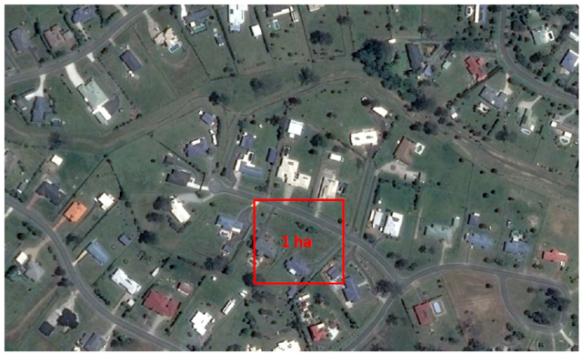
- Small acreage subdivisions with fewer than 1 house per 1,000 m² (or 10 per hectare)
- Areas with 2 to 10 large trees, groups of trees, or buildings per hectare (≈ 25–140 per cardinal sector)
- In cyclonic areas, terrain with:
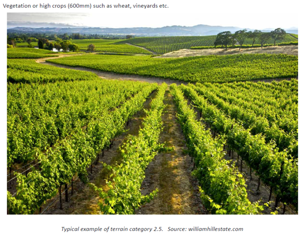
- Vegetation or high crops (≥ 600 mm), such as:
- Sugar cane
- Wheat
- Vineyards
- Vegetation or high crops (≥ 600 mm), such as:
Tips, Best Practices & Troubleshooting
- Use satellite imagery to count obstructions per hectare for classification.
- For borderline cases between TC 2.5 and TC 3, consult engineering support.
- Consider local vegetation and building density in all directions (cardinal sectors).
Related Resources
Request Engineering (Site Check)
Review & Updates
Version History:
- v1.0 – 18 March 2019
- v2.0 – 31 July 2025
Article Information
- Category: Engineering & Site Specifications
- Target Audience: Estimators, Sales Coordinators, Franchise Users
- Business Owner:
- Version: v2.0
- Last Reviewed: 31 July 2025